The newest weapon for fighting climate change
Saildrone has deployed over 100 AI-equipped drone sail boats to monitor ocean and weather data, count fish populations and map the ocean floor.
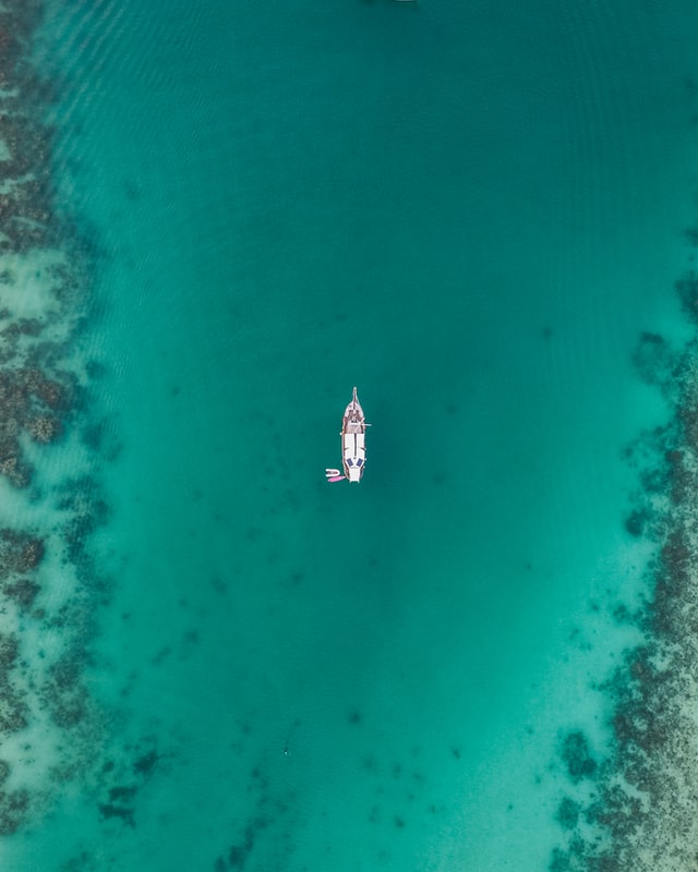
Drones aren’t just flying through the air — they’re also sailing the Pacific Ocean as the newest scientific weapon to combat climate change. The hope is that by mapping the ocean floor, collecting weather and ocean data, and counting fish and wildlife populations, the autonomous Saildrones will measure the changes happening right now on our planet.
Climate change is reshaping planet Earth, causing sea levels to rise, melting Arctic ice and raising global temperatures. According to NASA, the global average sea level has risen seven inches over the past 100 years. Arctic summer sea ice has shrunk to its lowest levels on record, and the average global temperature has gone up 2.1 degrees Fahrenheit since 2000, posing a threat to life as we know it.
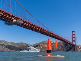
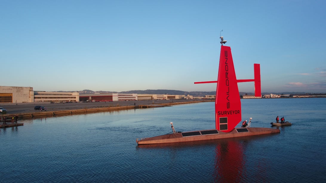
The Saildrones are made by an Alameda, California-based company that bears the same name. Looking a bit like a futuristic kayak with pontoons (they measure 23 feet long), the bright red Saildrones have a sail with solar panels (they’re sun-powered and are pushed by the wind) and an airplane-like tail. Outfitted with a number of data sensors, radar equipment and high-resolution cameras, they monitor factors like ocean currents, wind speeds, sunlight radiation, sea and air temperature, relative humidity and carbon dioxide emissions and relay it back via satellite to Saildrone headquarters. https://www.youtube.com/embed/9XoTAvcKgOE
I spoke with Brian Connon, Saildrone’s vice president of ocean mapping, from an abandoned Navy base where the company’s drones are manufactured and deployed into the Pacific Ocean.
“For the last seven or eight years, we’ve been using [Saildrones] to collect ocean data and help inform our science on things like climate change, meteorology and oceanography,” he said. “Is [carbon dioxide] being ingested by the ocean, or is it being exhaled by the ocean? We can measure that carbon flux in the atmosphere, right at the sea’s surface.”
Saildrones are even equipped with artificial intelligence so they can maneuver on their own and conduct missions anywhere around the world without refueling or assistance by humans for months on end. Their ability to travel in harsh environments like the Arctic make them incredibly valuable in terms of crew safety and cost effectiveness.
Connon said Saildron’s customers can follow a drone’s progress online in real time, view the photos it’s taking, and analyze the weather and ocean observations that it’s making at the time.
“AI is really about programming them to go to a location and then conduct a mission,” he said. “A lot of that is very preplanned by us [at headquarters], and then the Saildrone goes off and does its work, and we just kind of keep an eye on it via satellite communications.”
Saildrones use single beam and multibeam sonar bathymetry to map the ocean landscape, providing a detailed view of the ocean floor. The Surveyor, a massive autonomous Saildrone, is getting ready to take on this challenge of mapping all of the planet’s oceans, which make up more than 70% of the Earth’s surface area.
“It’s outfitted with sonars that can record the depths of the bottom, Cannon said. “And we hope to use that to fill in all the gaps in our what we call bathymetry around the world.”
The Saildrones also can help control overfishing by counting fish populations using sonar technology and informing governments about how many fish can be caught each season. Connon described how they’ve been able to count king crabs.
“They’ve tagged a number of king crabs and can watch them as the scurry across the ocean bottom,” he said. “We’re able to use a Saildrone to locate those acoustic tags and then listen from the surface and see where those king crabs are going.”
Saildrone is also experimenting with a new concept known as maritime domain awareness, in which a small fleet of drones is deployed to monitor and patrol a small maritime region. Saildrone conducted demonstrations in Hawaii in October 2020 sending a group of drones out to identify fishing boats, monitor ocean conditions, and keep a high-resolution eye out for illegal activities like drug smuggling and illegal fishing. They can relay images of suspicious boats that may not have proper identification numbers or identify vessels that could be in distress.
The more than 100 Saildrones built so far have proven to be valuable by helping to correlate satellite data with NASA and National Oceanic and Atmospheric Administration satellites and confirm information collected 24/7 from outer space and the ocean’s surface. They’re also setting records. In 2019, a Saildrone circumnavigated the Southern Ocean, traveling more than 1,400 miles around Antarctica observing carbon dioxide outgassing during the winter. Later that year, a Saildrone became the first and fastest unmanned vehicle to cross the Atlantic in both directions, completing the journey in just 68 days.

Saildrone founder and CEO Richard Jenkins is no stranger to world records himself. In 2009, he broke the unpowered land speed record in the Mojave desert, traveling 126.2 miles per hour in a wind-powered vehicle designed by Greenbird, using the same wing design that would become the inspiration for today’s Saildrone.
Connon is optimistic about the future of his company. “We’re in an old air station hangar, so we’re reusing government buildings as a US owned and operated company doing great things for the Earth,” he said. “We’re doing things in a low carbon footprint way, and we’re trying to help everyone understand the Earth. I think it’s really a great mission for a company to be able to do this.”